

Precision Sampling: Task Management App's
Discover how mobile task management apps transform per-tree sampling with drone data, AI insights, and real-time tracking for yield and quality optimisation.

The smartphone in your pocket is one of the most powerful agricultural tools of the Fourth Industrial Revolution (4IR).
Combined with IoT devices, cloud computing, and high-resolution remote sensing, it’s reshaping how farm managers assign work, track progress, and ensure quality in the field.
For some operations, task management still means pen, paper, and verbal instructions.
While these methods have served farmers for decades, they are slow, prone to human error, and difficult to track over time. Records can be misplaced, handwriting misread, and follow-up almost impossible without physically chasing the paper trail.
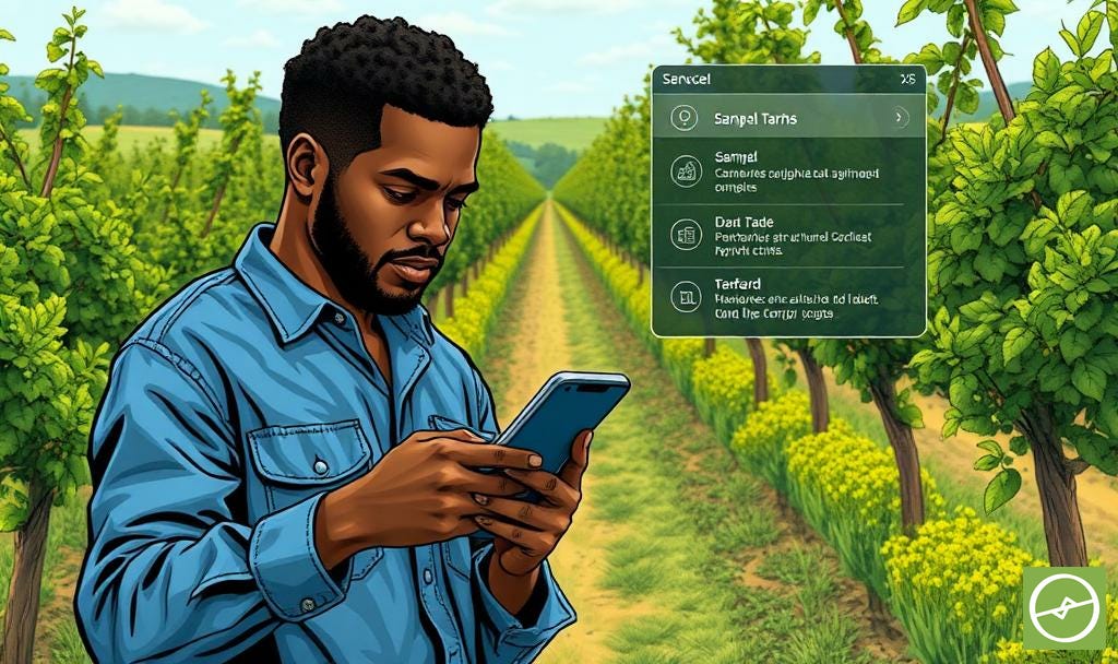
Digital task management apps remove these shortcomings.
They centralise all instructions, records, and updates in one accessible platform. Tasks can be assigned instantly, monitored in real time, and recorded with precise GPS coordinates.
This improves accuracy, ensures consistent execution, and creates a digital history of every action taken.
The 4IR Connection
The Fourth Industrial Revolution (4IR) describes the fusion of physical, digital, and biological systems through advanced technologies.
In agriculture, it’s the convergence of automation, artificial intelligence, IoT devices, robotics, and big data - all working together to make farming more precise, efficient, and sustainable.
4IR technologies link the physical and digital worlds.
Drones capture aerial data; AI processes it; the cloud delivers it; smartphones action it. Each element in the chain is interconnected - enabling the kind of precision, efficiency, and responsiveness that was impossible a decade ago.
This interconnectedness isn’t just about speed. It’s about traceability and accountability. When a scout completes a sampling task, the app logs who did it, when, and where.
This record becomes part of the farm’s digital history - essential for compliance, sustainability audits, and continuous improvement.
Why Drone Data Matters for Sampling Accuracy
Many agricultural apps rely on low-resolution satellite imagery, often based on older datasets like those found in Google Earth. While useful for broad mapping, they lack the precision needed for per-tree sampling.
Drone data changes the game.
High-resolution imagery lets users see individual trees and their exact GPS locations.
This makes it easier for field staff to locate the right sampling points and ensures that data is captured from the correct trees - improving accuracy and repeatability.
This higher resolution layer also enhances the user experience: you can clearly see where you are in the orchard, not just a vague block outline from space.
Why It Matters for Sustainability and Food Security
Efficient sampling helps identify issues early.
Nutrient deficiencies, pest outbreaks, irrigation problems…. Tackling these quickly prevents yield loss, reduces waste, and makes better use of inputs. Critical steps for both farm profitability and the global challenge of producing more food with fewer resources.
By ensuring sampling is targeted, repeatable, and well-documented, task management apps reduce the hit-or-miss nature of manual scouting.
This supports consistent decision-making, better resource allocation, and ultimately, a more reliable food supply chain.
Practical Guidance for Managers
Integrate with Your Data Sources
Choose software that can pull in drone, satellite, or sensor-derived data. The best systems let you select sample trees based on canopy health, NDVI/NDRE values, historical performance, or other relevant factors.
AI-generated sampling points are also becoming more prevalent - helping to enhance orchard relevance (representative trees).
Assign Tasks Intelligently
Use GPS-marked trees to guide field staff.
Many apps provide navigation directly within the interface, reducing wasted time and ensuring the right trees are sampled.
For example, the Aerobotics app allows managers to create in-field scouting and sampling tasks directly from drone or sensor insights - including pest trap and disease monitoring, as well as crop sizing and quality measurements.
Assigning these tasks to specific individuals means managers can track who collected data, where, and when.
This creates a clear record for tracing poor data capture, especially if anything falls below the minimum requirements or sampling recommendations. This accountability helps maintain consistency and quality in yield optimisation programmes.
Enable Offline Functionality
Field connectivity (cellphone coverage) is rarely perfect.
Your system should allow full functionality offline, syncing automatically when coverage is restored, or when within range of an office WiFi hotspot.
Use Barcodes, QR Codes, and Push Notifications
Barcodes / QR codes can link sample bags or records directly to specific trees or blocks.
Push notifications keep staff updated on urgent tasks or changing priorities.
RSS feeds or automated reporting can keep managers informed without manual follow-ups.
Maintain Office–Field Continuity
Your platform should work equally well in a browser for planning and analysis, and on mobile devices for execution. The office and the orchard must speak the same digital language.
Focus on Accountability and Record-keeping
Every completed task should leave a clear digital trail: date, time, location, assignee, and result. This not only improves quality control but supports traceability in your supply chain.
The Power of Looking Back While Moving Forward
The benefits of task management apps go beyond daily sampling efficiency:
They store all completed tasks and data in a centralised system, so managers can look back over time - tracking trends in orchard performance. The same principle at the core of historical change detection.
When integrated with AI-driven analytics, these systems can also power AI-assisted in-field inspections.
Drones and sensors identify areas or trees needing attention; the app translates those insights into potential tasks. These can be assigned, and field teams act on them with precision.
The result is a complete feedback loop: from detection, to action, to review.
Taking Remote Sensing to the Next Level
Remote sensing tells you what needs attention.
Task management apps tell you who will take action, when, and how.
Together, they close the loop: turning data into action, and action into measurable outcomes.
In a world where sustainability and operational efficiency are both business imperatives, this integration is more than a convenience. It’s a competitive advantage.
Be courageous. The thinking starts here, but the real change starts when you take action.