

The Drone Advantage for Perennial Crops: Hardware, Sensors, and AI-Smart Outputs
A quick guide to choosing the right drone data strategy, sensor payloads, and data metrics for orchards and vineyards - from map layers to per-tree metrics and AI-guided sampling.

Drones are tools, and the value sits in data, plus the decisions that follow.
Good decisions need two things: Knowledge and critical thinking.
The first supplies facts. The second tests them; weighs trade-offs; cuts emotion.
This is how drone data becomes leverage for successful perennial crop production.
It’s imperative to understand the basics like platform types, sensor choices, and basic flight planning etiquette (even if you are not the pilot) and the most important output formats.
With this information in hand, we maintain a level of control, tend to ask better questions, and land up investing in the right services and partners.
Layers that build leverage
Survey drones make sense for mapping, monitoring, and repeated data capture. Perfect for crops that remain in the ground for decades, the play is twofold: Quick reads now; and trend lines over time. Near-term fixes and long-term impact.
The fundamental advantage of the initial survey is speed. Fresh information and early action. The strategic advantage lies in building history.
Each drone scan adds another chapter - while you plan and execute with clarity.
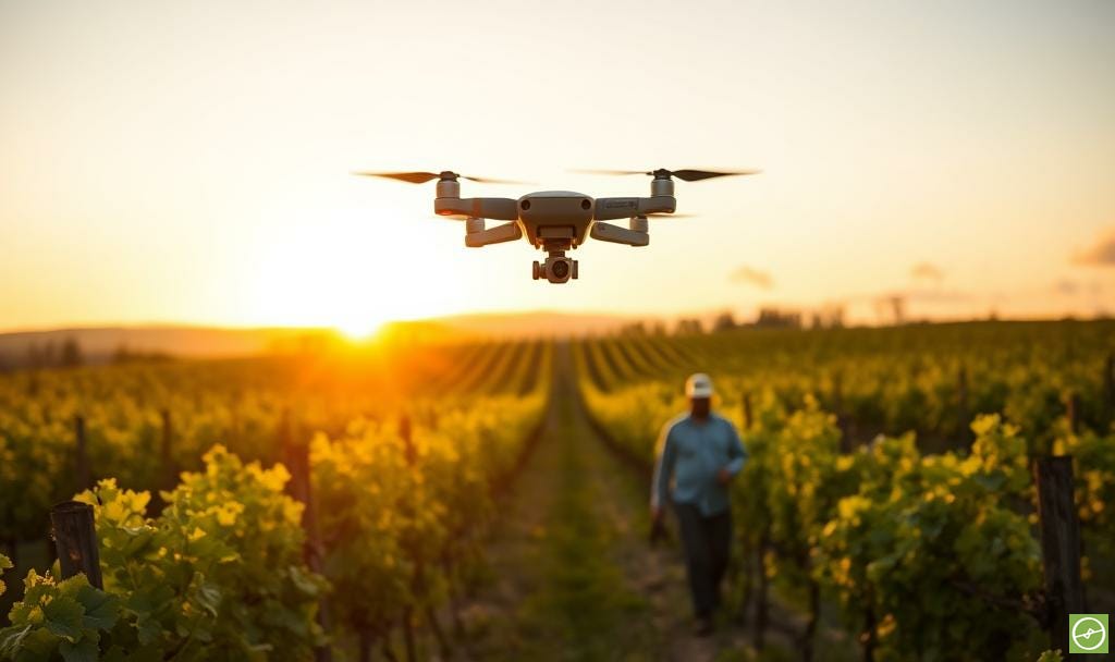
Choose your airframe wisely
Fixed-wing: Cover big areas efficiently; carry heavier payloads; need open space to launch and land. No hover. Strong when coverage is king.
Multi-rotor: Agile; precise; low-altitude detail. Ideal for irregular blocks or mixed terrain. Shorter flight times; multiple batteries for big jobs. A practical choice for most orchards.
VTOL: Hybrid flexibility. Vertical take-off; fixed-wing cruise. Excellent range with targeted hover when needed. More complex and costly, and requires skill to run well.
Hardware, sensors, and pre-flight strategy
In terms of hardware, the airframe endurance, payload capacity, and reliability matter. So do batteries and robust frames. Match the platform to terrain, crop, and urgency. Then choose the payload that serves the question you want answered.
In terms of sensors, RGB gives true-colour context and feeds elevation models. Multispectral adds near-infrared and red-edge for vegetation indices. Thermal shows transpiration patterns and irrigation uniformity. Modular payloads add flexibility, but also complexity. Balance both as best you can.
Over and above hardware and sensor choices, remember that wind, temperature, light, and terrain affect stability and quality. As such, you (or your data capture provider) need to plan and execute well.
Also, there must be a cultivated habit of building redundancy into every drone flight mission. Back-up drone/s, extra batteries, spare SD cards. A clear plan of action, tight checklists, and professional protocols - which ensures high-quality data capture in a world where anything could go wrong.
Four ways you can get hold of drone data:
End-to-end provider: They fly, process, and deliver insights in a platform. Fast and convenient; priced accordingly. Service quality must match the premium.
Local pilot plus third-party analytics: Flexible and often faster on short notice. You manage two relationships; pilot and processor.
In-house flying; outsourced processing: Control timing and frequency without building a data science team. Good if you scan often.
Fully in-house: Flight, processing, software, and support under one roof. Suits large enterprises and research groups. Higher cost; higher skill.
From imagery to insight: three output views
Map layers (orthomosaic): A stitched, geo-referenced view of the block. Useful for baselines, broad patterns, and time-based comparisons.
Zonal representations: Groups of similar performance. Simple to interpret; ideal for sampling design and variable-rate strategies.
Per-plant metrics: The fine detail. Each tree tagged with canopy size, health, and thermal indicators. Outliers stand out. Actions get precise; inventory traceable.
Know the core metric types
RGB visuals: Foundation layer for context, canopy form, surface models, and change detection.
Digital Elevation Models (DEMs): Terrain, slope, and drain paths via photogrammetry; guides layout, water flow, and access.
Multispectral: NDVI for broad “greenness” values. NDRE for chlorophyll depth in denser canopies. Use both with phenology and asset age in mind.
Canopy metrics: Per-tree area and indicative volume. Pair with health for growth and uniformity tracking.
Plant census: Accurate counts; gaps; decline patterns. Underpins replant budgets and insurance.
Thermal data: Transpiration and irrigation performance; highlights stress, blocked emitters, and frost-risk zones.
AI-generated waypoints: Turn metrics into on-ground action; guide teams to representative or anomalous trees for sampling and checks.
Where fruit meets data
Smart “precision sampling” strategies link aerial insights to targeted plants, as well as yield measurements, monitoring, and forecasts.
Representative trees or vines, guided by per-plant informations, improves data collection practices and projections; while harvest planning gets sharper while marketing efforts are based more on fact than thumb-suck.
This is where drone-derived per-tree datasets stack with fruit and nut sizing technology (including AI) to drive ROI-positive decisions.
Bring it back to the orchard
Start simple. Pick the hardware platform that fits your context. Choose the sensor that fits your needs and solves for pain-points. Plan flights with care - or hire a professional. Insist on outputs you can act on: maps, zones, trees. And build a record over time. This is where confidence starts, and grows.
The thinking starts here, but the real change starts when we take action.
This post is a summarised and adapted excerpt from Chapter 2 of my upcoming book, Drone Data Metrics for Orchard Farming.