

Why are UAVs the Perfect Platform for Mapping?
How Gimbal Stabilisation and the Nature of Drones Make RGB Drone Imagery Work: Sharper Maps, Reliable Per-Tree Insights, Better Orchard Decisions

I covered RGB image capture and the power of the often underestimated Red-Green-Blue datasets in a previous post.
However, capturing colour is only part of the story. The quality of each image depends on how steadily the sensor can record it during flight.
Without stability it’s hard to make sense of any recordings. Processing the imagery becomes a nightmare. Time and resources are wasted; where they should have been leveraged.
As we know, drones operate in variable conditions (wind, turbulence, and rapid manoeuvres), all of which can introduce blur or distortion. For agricultural mapping, and in any situation where precision matters, stabilisation is just as important as the sensor itself.
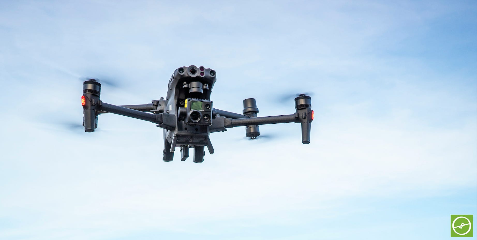
Most agricultural drones mount their cameras on a stabilising gimbal. This three-axis support system actively counters vibrations and movement in real time, keeping the camera steady and level throughout mapping.
By isolating the sensor from external motion, gimbals ensure that each image is sharp, consistent, and ready for stitching and further processing.
In practice this means cleaner maps, reliable per-tree analysis, and greater confidence in the outputs derived from RGB imagery obtained during mapping flights.
Sharper imagery for precise measurement and mapping, consistent perspective across images, and reduced distortion even during less-than-ideal flying conditions. The gimbal is one of the unsung heroes in our drone-tech arsenal.
Why Quality is King (RGB Perspective)
The quality of raw imagery is critical - and in the case of RGB data for example - it forms a base layer for generating downstream outputs.
Every orthomosaic, every digital elevation model, and the accuracy of plant annotations rely in most cases on sharp, crisp, and impeccably aligned RGB imagery. If the base layer is flawed, every subsequent layer could carry that flaw.
This is why high-quality RGB capture is not only about recording a “pretty picture” from above, but about recording one that’s clear and precise.
Clear imagery is about securing a reliable foundation on which the rest of the data analysis can stand firm. And thus, an important building block within the drone data capture process.
When RGB is done well, it anchors much of the data stack, ensuring that insights around tree counts, canopy growth, and gradient are trustworthy and reliable.
Can you conduct drone scans for a non-RGB survey - skipping the RGB layer completely? Yes - but the rules of stability apply regardless.
While some multispectral or thermal camera sensors utilise a gimbal, some do not. Luckily for us, the very nature of the UAV platform itself offers a certain level of stability. Another reason why drones used for mapping are such a great choice.
Compared to manned or unmanned ground based vehicles (UGVs), drones are unmatched as they are not restrained by having to track the terrain physically.
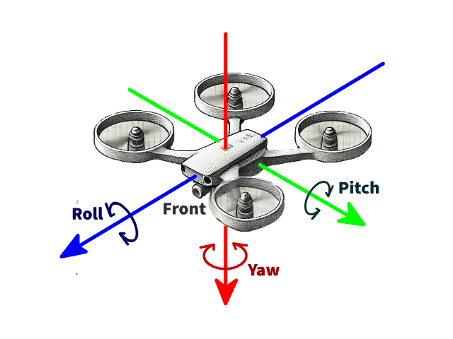
Although drones (UAVs) have wind and weather to contend with, they adjust speed and flight angles to compensate - in a way becoming the gimbal themselves - with pitch, yaw, and roll.
A pilot’s mindfulness about terrain changes, weather, flight parameters, and the hardware required to get the job done correctly, all affect the stability of the flight and image capture, and ultimately the data capture results.
At this point I have to mention that it’s important to work with an expert service provider. Choose a data-capture partner you can trust, who can supply you with examples of their work and reliable references.
And if you’re flying yourself, do the required training to make sure that any data capture (no matter the sensor) is done in a professional manner to ensure the best results.
For more on drone data capture, metrics types, and practical applications in real-work scenarios, check out my new book: Drone Data Metrics for Orchard Farming.
The thinking starts here, but the real change starts when we take action.
Kindle Preorders Open: Drone Data Metrics for Orchard Farming - Launching Nov 20th.

As some of you might know, I’ve been working on this most of 2025... and I’m excited to finally share it.